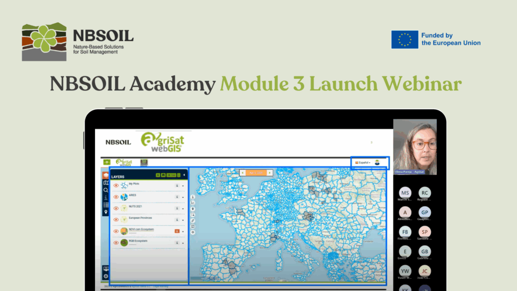
The NBSOIL Academy’s Module 3 launch webinar unveiled a range of digital tools for soil health monitoring and mapping. Presented by project partners ITAP, Agrisat, BC3, and ILOT, the event showcased the wealth of knowledge and resources available to soil advisors as part of the NBSOIL Academy. Attendees also received guidance from representatives of the University of Torino (also NBSOIL partners) on how to navigate the e-learning platform. This new module builds on the project’s overall commitment to sustainable land management.
Module 3 is designed to empower future soil advisors with skills in applying digital tools for soil health monitoring. Students will learn how to monitor and map soil health more accurately and efficiently, discover cutting-edge digital tools from the NBSOIL portfolio, and understand how to integrate information from multiple sources.
The module includes theoretical content and examples of various digital tools for soil health monitoring, such as drones, satellites, and sensors. It also introduces platforms like Copernicus, ARIES, and the Agrisat GIS Tool.
Learning is supported by quizzes, multimedia resources, practical tips, and self-assessment tests, making the experience interactive and engaging. In Levels 2 and 3, students will also explore case studies to apply the theoretical knowledge in practice.
In addition, the module provides information on relevant devices and products for soil health monitoring, including their applications, advantages, limitations, and price ranges. This aims to support both current and aspiring soil advisors in selecting the most appropriate tools for their specific needs.
NBSOIL Tools: GIS and ARIES
Elena Pareja, from Agrisat – a partner in the NBSOIL consortium – presented the GIS Tool, which forms the core of the training exercises in Module 3. The NBSOIL GIS Tool was developed by adapting the Agrisat WebGIS Tool and ARIES, with a key feature: it works on both desktop and mobile, allowing farmers to record and upload soil data directly from the field, complete with GPS location and timestamps. Results are stored digitally, streamlining both record-keeping and reporting for regulatory compliance.
The GIS Tool includes a map viewer that enables the visualisation and temporal analysis of various Earth Observation data sources, including images from the Sentinel-2 satellites (operated by the European Space Agency) and Landsat (operated by NASA). It can also incorporate other georeferenced data, either via connections with other Spatial Data Infrastructures (SDIs) or through external models and databases such as ARIES.
Yuwei Wu, from BC3 – also an NBSOIL partner – introduced the ARIES NBSOIL Open Library, a user-friendly platform that provides open access to soil-related knowledge, fully aligned with the FAIR principles: Findable, Accessible, Interoperable, and Reusable. Through ARIES’ semantic web services, users can explore a wide range of soil health variables and modelling components, freely available following a quick registration. ARIES (Artificial Intelligence for Environment & Sustainability), hosted by BC3, aims to transform data-intensive science for decision-making by ensuring that scientific data and models follow FAIR principles.
Satellite Imaging and Sensors Combine for Smarter Soil Management
A highlight of the webinar was the demonstration by NBSOIL partner ILOT of remote sensing technology, using drone and satellite imagery to provide large-scale views of soil and crop health. Through interactive dashboards, users can quickly identify areas of stress in fields, with colour-coded maps offering a clear, visual guide to soil conditions over time.
Marcin Spiralski, from ILOT, demonstrated how unmanned aerial vehicle (UAV) imagery can support crop inspection or soil mapping, such as vegetation analysis, soil moisture levels, or forest erosion monitoring.
In addition, the webinar showcased innovative sensor networks deployed directly in the field. These devices continuously measure key soil parameters such as moisture, temperature, and pH, transmitting live data to cloud platforms. This enables farmers to act quickly, helping prevent potential crop losses before they escalate.
Empowering Sustainable Agriculture
Speaking at the event, organisers emphasised how these digital tools are reshaping sustainable farming practices. Equipping land managers with real-time data means moving from reactive to proactive soil management. It’s about using technology to farm smarter – improving yields, reducing waste, and protecting the long-term health of our soils, presenters explained.
Participants were also given guidance on accessing further training resources, including opportunities for hands-on fieldwork to put the tools into practice. Digital technologies like those featured in Module 3 of the NBSOIL Academy could prove vital in helping European agriculture meet the challenges ahead – boosting productivity while safeguarding the environment.
