The Visioning Cards provide a flexible visual language for describing and defining soil problems and solutions. The cards help soil advisors and educators explain soil health concepts to diverse audiences. They summarise information found in soil textbooks and manuals. This page suggests ways to use each deck, but users are encouraged to improvise. These cards make learning about soil engaging and fun.
Deck description
This deck contains cards for the five Biogeographical regions present in the NBSOIL consortium countries: Continental (Poland); Mediterranean (Spain and Italy); Atlantic (United Kingdom, France, and The Netherlands); Alpine (Switzerland and Austria); and Pannonian (Austria).
How to use the cards in this deck – introduce the climatic context
We recommend using this card early in the session in order to introduce the climatic context of the areas involved in your session. You will need to complement the card with information at a regional (NUTS2) and local level, and can be used as an opportunity to gather participant’s impressions on extreme weather episodes, changes in weather, perception of climate change and associated risks, possibilities for adaptation, etc.
References
Additional resources for preparing workshops and sessions
Deck description
This deck is an adaptation of the 8 cards presenting the Soil Mission objectives and challenges originally designed by the Soil Mission Secretariat, they have been slightly modified to make it more homogenous in terms of colour hues and designs with the other cards. They depict the Soil Mission Objectives as presented on the Soil Mission website.
How to use the cards in this deck
This deck is conceptually related to the soil threats, but it can also be used at the beginning of the session or whenever required to present the Soil Mission and its objectives.
When used within broader advisory or planning processes, it should help to link the Soil Mission and its resources, accessible through the Soil Mission Implementation Platform, with the actual problems being faced by the participants.
References
Additional resources for preparing workshops and sessions:
Deck description
This deck presents the 6 broad nature-based solutions (NBS) categories that are being explored by NBSOIL as potential solutions to soil related challenges across the four soil use sectors. The NBS are: organic fertiliser, bioremediation, cover crops, paludiculture, forest diversification and blue-green infrastructure.
How to use the cards in this deck
These cards will support advisors in proposing NBS related with the Soil Mission objectives and challenges and other resources, and adequate for the involved soil use sector(s), the climatic context and the identified soil threats. The NBS categories are: organic fertiliser, bioremediation, cover crops, paludiculture, forest diversification and blue-green infrastructure. These are all already well known “green solutions”, which with the support of the IUCN criteria for NBS can be designed to optimise environmental, social and economic positive impacts. There are plenty of resources on each of these categories, but somehow scattered. The NBSOIL project is gathering a “Soil and NBS handbook” but the NBS categories
These cards represent broad categories or “families” of solutions as a departure point for discussion. Once the most relevant categories for the assessed challenges have been identified, the advisor will need to gather more information on the specific NBS that fit into that category in order to be able to co-create a successful intervention strategy with the participants, culminating the advisory process.
We strongly recommend to come back to the soil biodiversity cards and link them to the NBS categories, as biodiversity underpins Nature Based Solutions and biodiversity preservation and recovery is one of the criteria.
Deck description
This deck contains the 8 criteria defined and described in Global Standard for Nature Based Solutions (NBS) by the International Union for the Conservation of Nature (IUCN):
The definitions have been summarised to better fit in the cards.
How to use the cards in this deck
This deck needs to be used together with the NBS categories to explain what is a Nature Based Solution, and how to design specific interventions to address all criteria. Deeper discussion will be needed to identify strengths, weakness, and potential trade-offs of the considered solutions and their implementation.
References
Additional resources for preparing workshops and sessions:
Deck description
This deck contains cards representing the Agricultural, Forestry, Urban and Industrial land uses in accordance with the Soil Health and Food Mission, indicating the proportion they occupy in the EU. For this final version, we have added some examples belonging to the Agricultural sector.
How to use the cards in this deck – identify soil uses and start participatory mapping.
We recommend identifying the different land use sectors treated in your session early now, just after introducing the climatic context. If your advice involved just one sector, typically agriculture or forestry, then you need to specify the different crops and types of forest involved. In any case, and specially when working with complex situations where all the soil uses interact and overlap, such as in many urban and peri urban areas, these cards need to be used together with maps. We recommend always using maps except in the simpler cases, the maps can be enhanced with the information and conclusions from each deck.
References
“Land use statistics – Statistics Explained.” (EUROSTAT, August 2023), URL
Deck description
This deck contains subdecks representing the 32 main orders of the World Reference Base for Soil Resources (WRB) system, which is the reference in Europe, and the 12 orders from the Soil Classification system devised by the United States Department of Agriculture (USDA) which is also often used by soil advisors.
USDA cards contain a short sentence summarising the main characteristics of this order:
WRB cards mention and show a representative example of each soil order
How to use the cards in this deck – describing and classifying soils
We recommend using this deck once the climate context and soil use sectors are identified with the help of a map. These cards will help participants navigate the diversity of soils and help provide a common understanding between different degrees of soil expertise and classification systems. Beyond the WRB and USDA systems presented here, the facilitator should consider the national soil classification systems available in some countries. Together with the scientific classification, participants should be encouraged to describe soil in their own terms, using the local names.
We suggest that the advisor or facilitator uses the chance to point out the relationship between the characteristics of a particular soil, how it is influenced by the climate and geology, and how that conditions its use. Discussions that aim to go beyond the introductory level should include local soil data, and, when available, local soil maps at higher resolution.
References
World Reference Base for Soil Resources (WRB) P. Schad, 2023.
Additional resources for preparing workshops and sessions
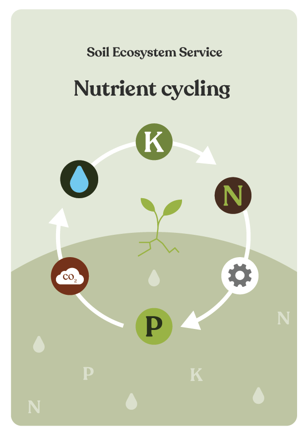
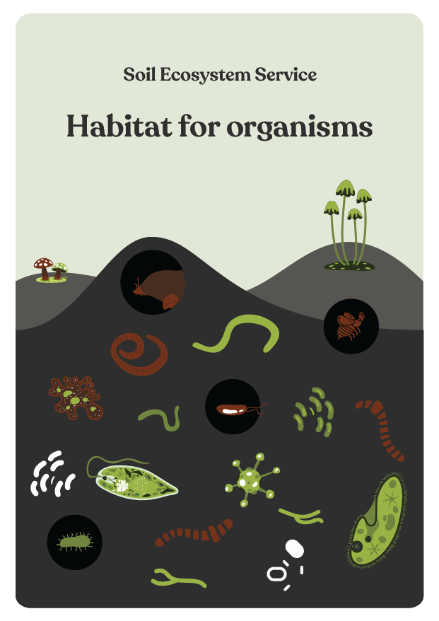
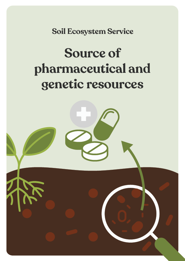
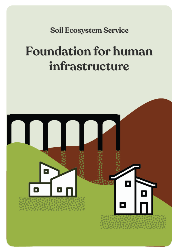
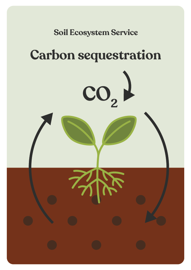
Deck description
This deck represents seven Soil Ecosystem services, inspired by the Food and Agriculture Organisation (FAO) infographic “Soil functions – soils deliver ecosystem services that enable life on Earth” infographic.
How to use the cards in this deck
These cards are meant to help advisors and facilitators to create awareness of the importance of soil and the way soil underpin our lives. We recommend letting participants choose which ecosystem services are more important to them and then engage in further discussion, mentioning other ecosystem services beyond what the cards describe and defining them in their own terms and according to their specific context, even identifying spatially on the map examples of particular soil types and areas providing ecosystem services. The advisor should emphasise the importance of soil in itself and for all life on earth before encouraging participants to answer the questions “why are soils important for you?” how do you depend on soils? in which ways do your activities relate to soils?”
Deck description
The cards present the most species -rich and well-known groups of organisms living in soils. It is adapted from the Figure of the recent article “Enumerating Soil Biodiversity” by Anthony, Bender and Van der Heijden (2023) which revealed that soil probably hosts approximately 60% of all species on Earth, demonstrating that soil is the most biodiverse singular habitat.
How to use the cards in this deck
This deck is meant to help advisors and facilitators explain about the importance of soil biodiversity, focus on certain groups of organisms and link their presence to the ecosystem services described in the previous step. We recommend using the cards together with the original figure showing the relative proportion of each group, illustrated by Michael Dandley, and when necessary and possibly go deeper with the help of the excellent Soil biodiversity Atlas available (see additional resources).
References
Additional resources for preparing workshops and sessions:
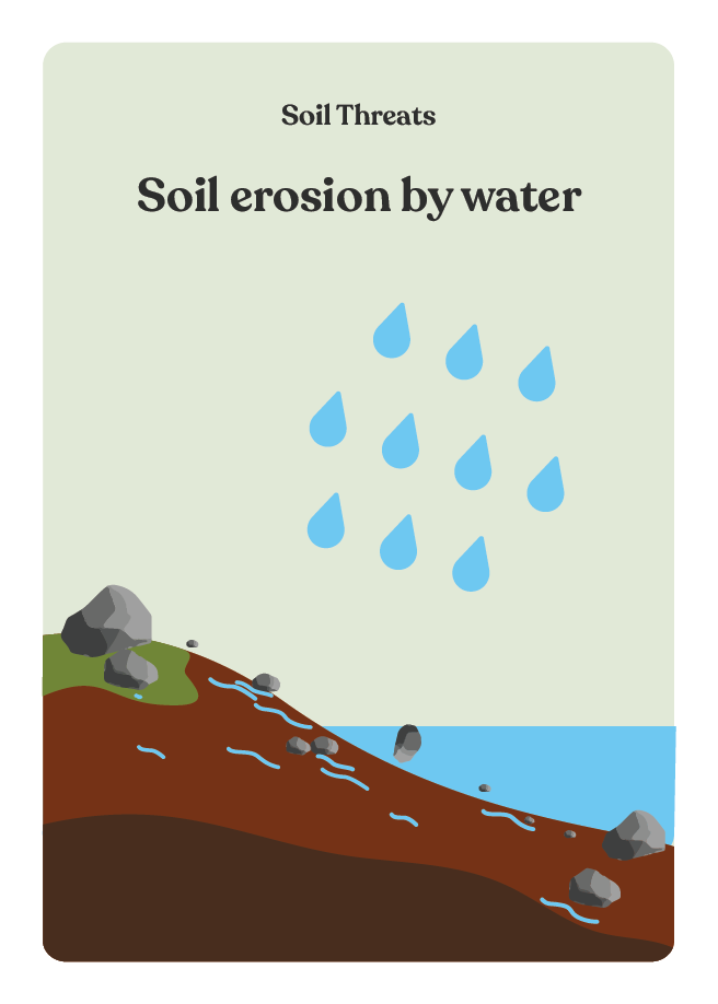
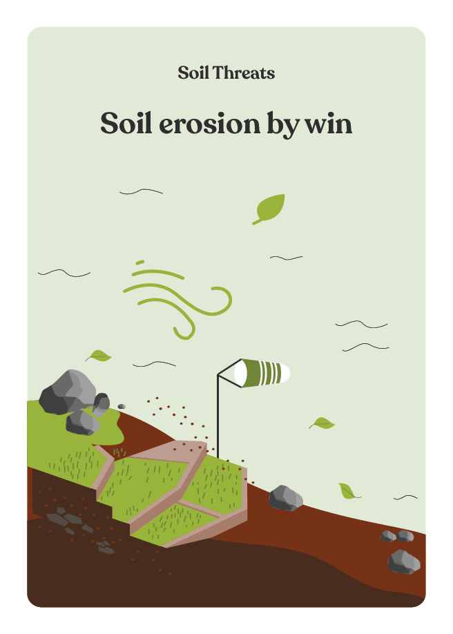
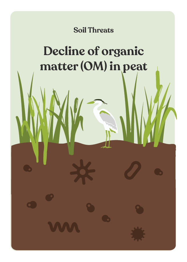
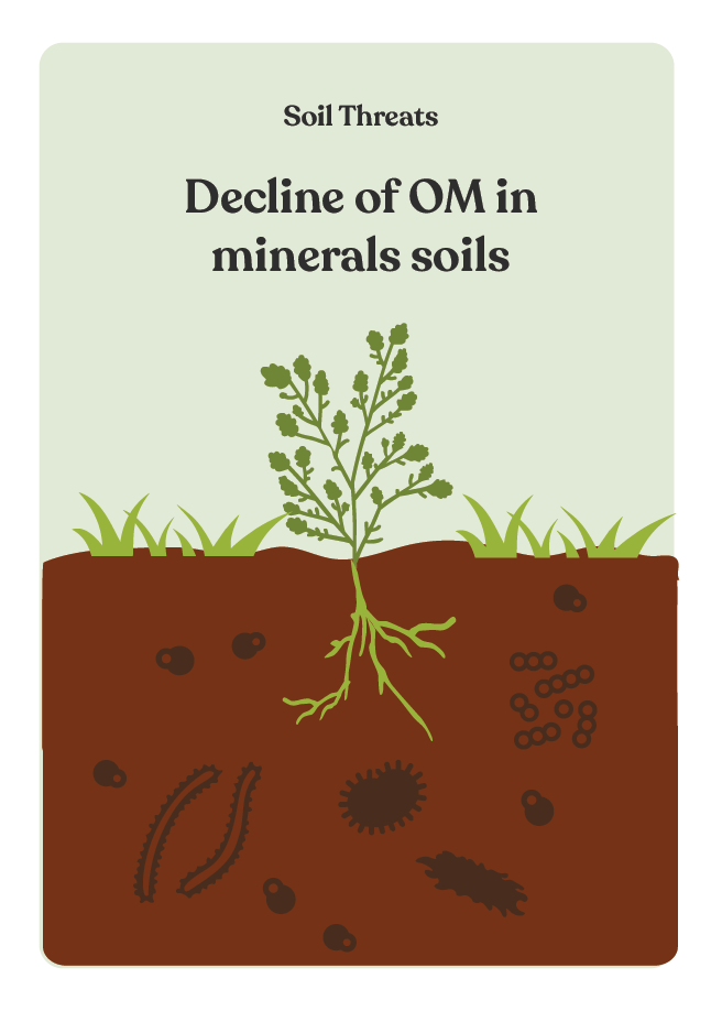
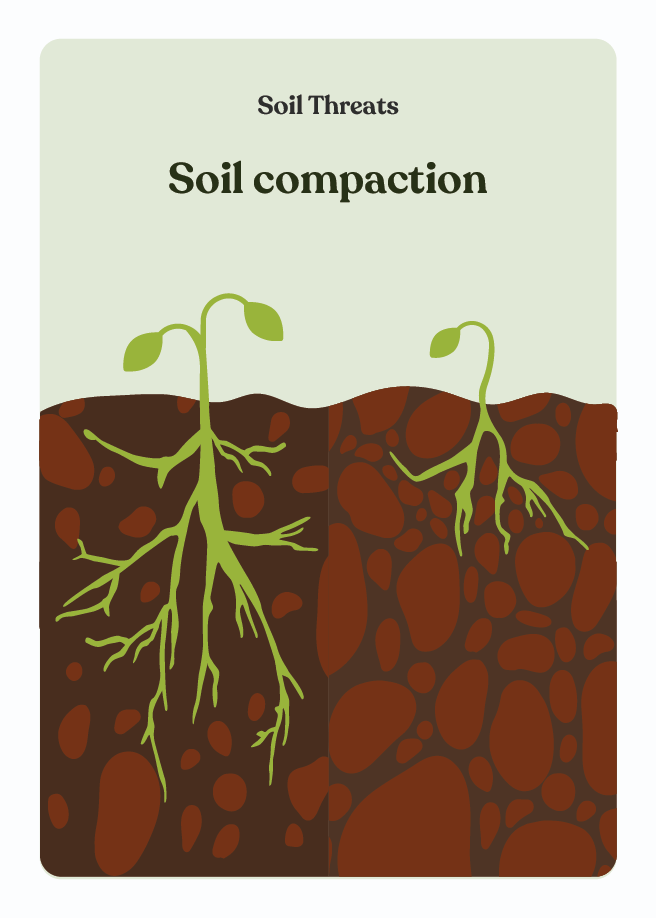
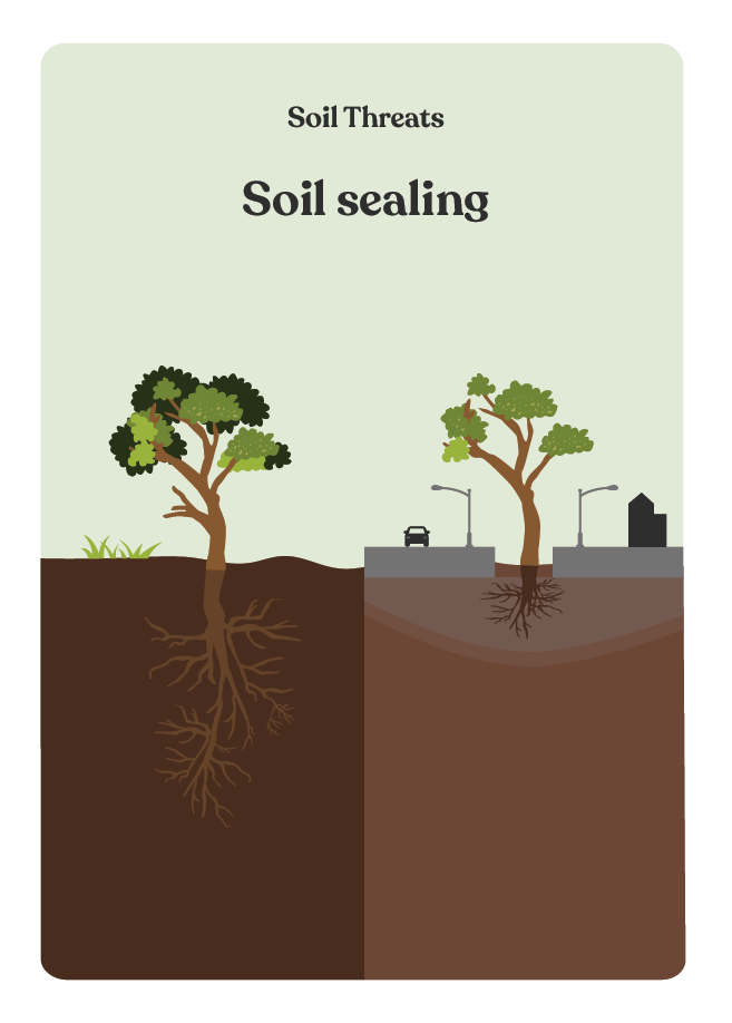
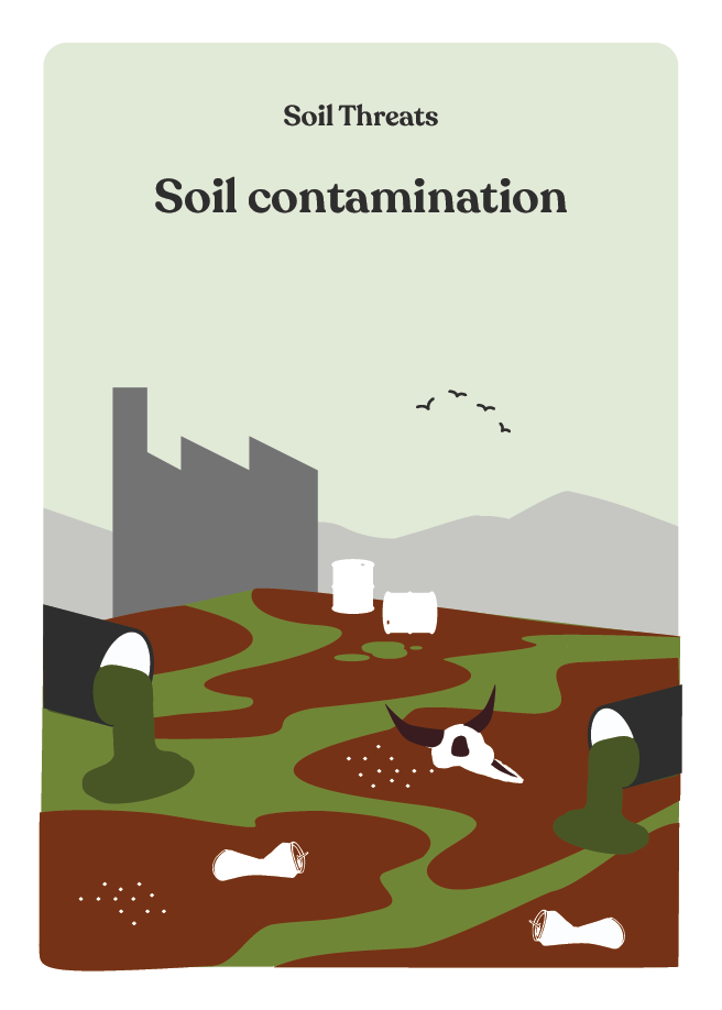
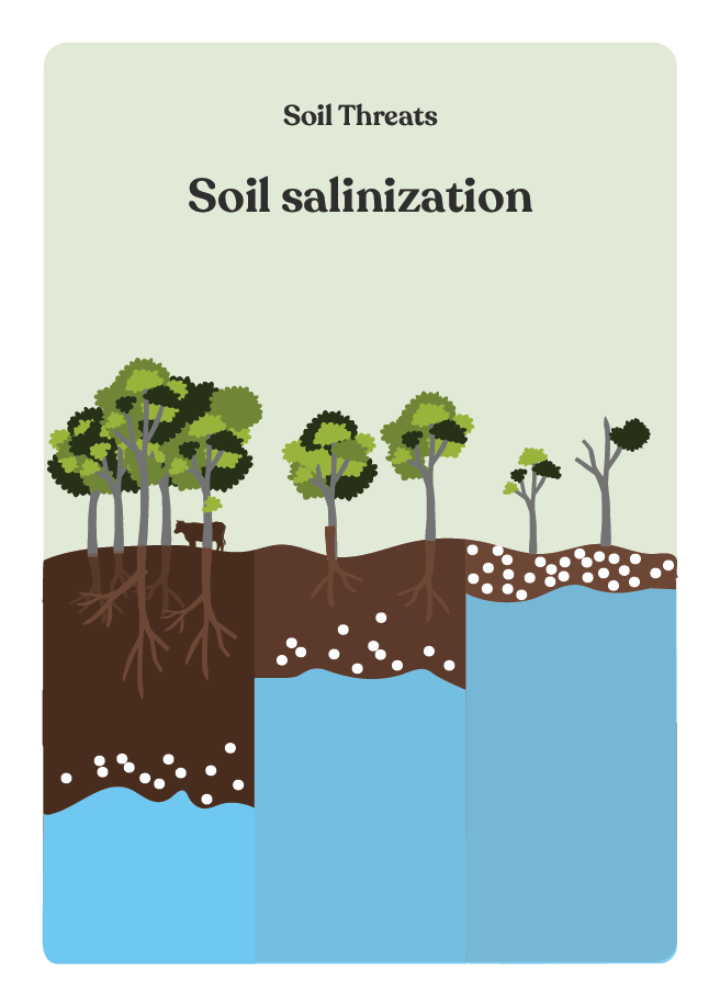
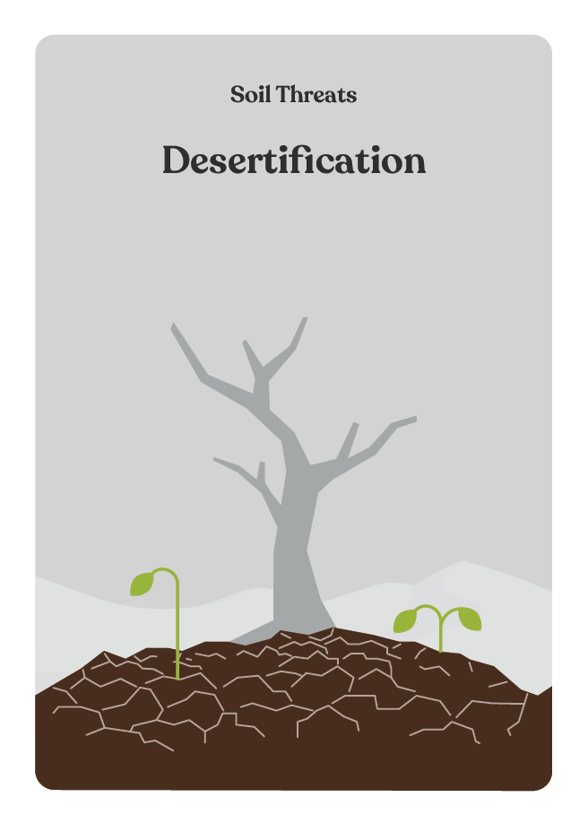
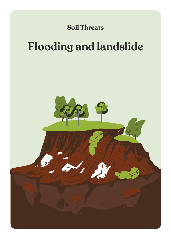
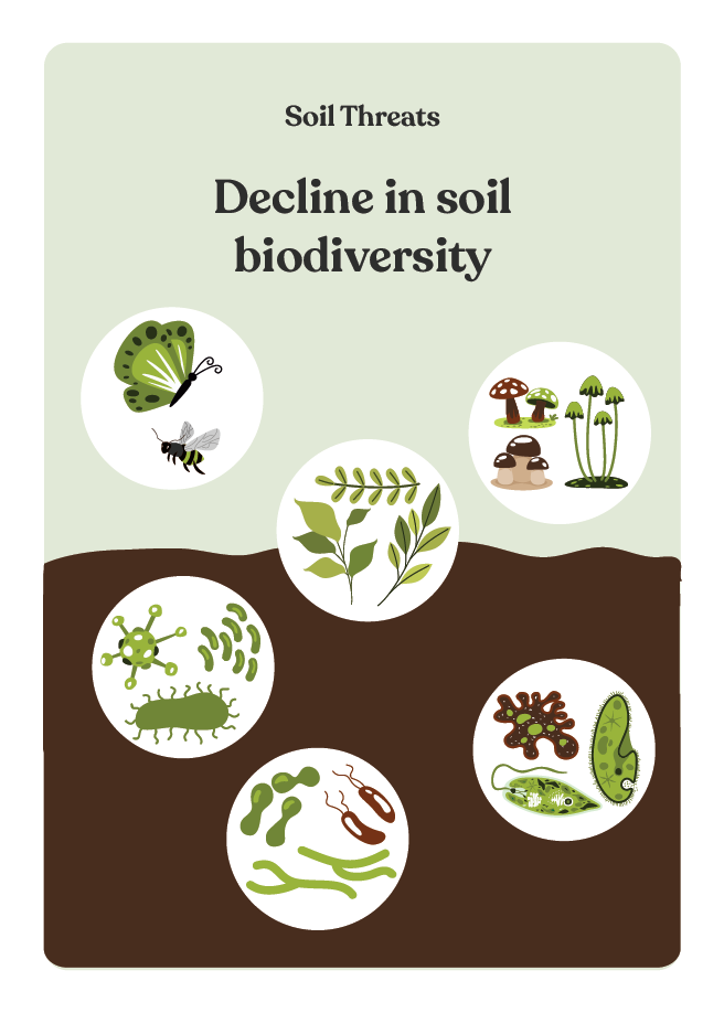
Deck description
This deck contains the 11 soil threats in Europe as described by Stolte et al (2016):
How to use the cards in this deck
These cards will help identify soil health related problems and place them in the context defined in previous steps, notably climate and land use. Alternatively, participants can be encouraged to mention the challenges and problems they are facing and then link them with the soil threats.
References
Additional resources for preparing workshops and sessions:
Project coordinator
Grzegorz Siebielec,
IUNG
gs@iung.pulawy.pl
Co-funded by the European Union. Views and opinions expressed are however those of the author(s) only and do not necessarily reflect those of the European Union or the European Research Executive Agency (REA). Neither the European Union nor the granting authority can be held responsible for them.
This work has received funding from UK Research and Innovation (UKRI) under the UK government’s Horizon Europe funding guarantee grant number 10061997.

This work has received funding from the Swiss State Secretariat for Education, Research and Innovation (SERI).
Website by REVOLVE | This website is run on 100% renewable energy | Privacy policy | Manage cookie consent